
Best Times to Fish & Hunt

★★★☆ Good

Major Periods

~2-hour windows centered on moon overhead and underfoot. Strongest feeding times.

  • 10:46 PM – 12:46 AM Moon overhead
  • 11:13 AM – 1:13 PM Moon underfoot

Minor Periods

~1-hour windows centered on moonrise and moonset. Secondary activity peaks.

  • 4:24 AM – 5:24 AM Moonset aligned with dawn/dusk

If you fish or hunt one window today — try 4:24 AM – 5:24 AM (it aligns with dawn or dusk).

Live Conditions · Bite Modifier

Today's bite is excellent

5 / 5

Live conditions support the solunar windows — this is a day to go.

  • Pre-front feeding window Pressure 29.94 inHg with a cold front in the next 24 hours — classic bass and crappie frenzy.
  • Walleye chop 7 mph wind makes the lake surface "walk" — bass crank, panfish feed shallow.
  • Mixed sky Patchy clouds give brief windows of feeding action — be ready when shade rolls through.

From the last NWS observation at . See the full live conditions bulletin for the data behind these calls.

Live Conditions · Movement Modifier

Today's deer movement looks excellent

5 / 5

Conditions favor deer movement — if you have time today, go.

  • Pre-front pressure drop Pressure 29.94 inHg falling toward a cold front — deer feed hard before the weather hits.
  • Cold front incoming Big temperature drop in the next 24 hours — primary feeding window opens before the front.
  • Steady working wind 7 mph — predictable scent stream, deer can't hear your footfall against it.

From the last NWS observation at . See the full live conditions bulletin for the data behind these calls.

Estimated Water Temperature

77°F on the Conecuh and the warmwater lakes

Anchored to: Yellow River read 64.2°F on Jan 7, 2026 · 4 months ago · air-temperature drift +21.7°F since

Anchored 12% on the most recent verified sample (Yellow River, 64.2°F on 2026-01-07) and 88% on the 5-day air-temperature proxy. The sample is 143 days old, so the proxy carries most of the weight; the verified reading still constrains the answer.

Species Active range Today
Largemouth bass 60–82°F Good
Crappie 50–70°F Hot
Bream / bluegill 70–85°F Peak
Channel catfish 70–85°F Peak
Striped bass 55–75°F Good

Recent verified water-temperature samples

From the EPA Water Quality Portal — ADEM Project 21AWIC and Alabama Water Watch citizen monitors. Sampling cadence varies by water body.

Water body Latest reading Sampled Sampling cadence
Yellow River 64.2°F Jan 7, 2026(4 months ago) 25 samples in 24 mo · avg 71°F
Frank Jackson Lake 71.5°F Oct 31, 2024(1+ years ago) 53 samples in 24 mo · avg 79°F
Point A Lake 72.3°F Oct 30, 2024(1+ years ago) 68 samples in 24 mo · avg 81°F
Gantt Lake 71.9°F Oct 30, 2024(1+ years ago) 95 samples in 24 mo · avg 82°F
Conecuh River no recent sample discontinued

Conecuh River temperature monitoring was discontinued in the early 2000s. Yellow River (YERC-3) is the most actively sampled water in the county and provides the best anchor for estimating current conditions on similar warmwater bodies nearby. EPA WQP →

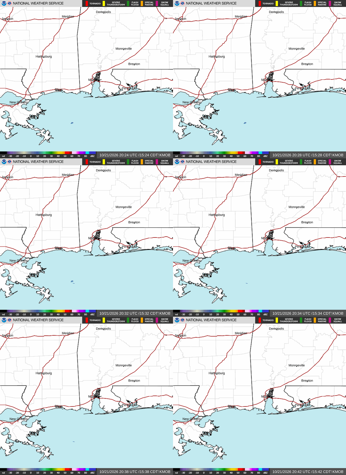
Live Weather Radar

What the Sky Is Doing

NWS Mobile (KMOB) Doppler — the radar that covers Andalusia. Refreshes every 10 minutes. Reload the page for the latest frames.

National Weather Service KMOB radar loop showing precipitation across south Alabama and the Florida panhandle

Source: NWS Mobile Radar (KMOB) · Andalusia sits 110 mi NE of the radar — small/light rain near the surface may not show; storm cells and fronts do.

The Next Two Weeks

Every day's major and minor periods, moon phase, and overall rating. Look for the ★★★★ days — they're the ones with periods that fall close to dawn or dusk.

Sat May 30
★★★☆ Good
  • 10:46 PM – 12:46 AM major · overhead
  • 11:13 AM – 1:13 PM major · underfoot
  • 4:24 AM – 5:24 AM minor · moonset
↑ 5:44 AM · ↓ 7:45 PM
Sun May 31
★★★☆ Good
  • 11:36 PM – 1:36 AM major · overhead
  • 12:02 PM – 2:02 PM major · underfoot
  • 7:06 PM – 8:06 PM minor · moonrise
  • 5:05 AM – 6:05 AM minor · moonset
↑ 5:44 AM · ↓ 7:46 PM
Mon Jun 1
★★★☆ Good
  • 12:27 AM – 2:27 AM major · overhead
  • 12:53 PM – 2:53 PM major · underfoot
  • 8:01 PM – 9:01 PM minor · moonrise
  • 5:52 AM – 6:52 AM minor · moonset
↑ 5:43 AM · ↓ 7:46 PM
Tue Jun 2
★★☆☆ Average
  • 1:19 AM – 3:19 AM major · overhead
  • 1:44 PM – 3:44 PM major · underfoot
  • 8:52 PM – 9:52 PM minor · moonrise
  • 6:45 AM – 7:45 AM minor · moonset
↑ 5:43 AM · ↓ 7:47 PM
Wed Jun 3
★★☆☆ Average
  • 2:11 AM – 4:11 AM major · overhead
  • 2:34 PM – 4:34 PM major · underfoot
  • 9:38 PM – 10:38 PM minor · moonrise
  • 7:42 AM – 8:42 AM minor · moonset
↑ 5:43 AM · ↓ 7:47 PM
Thu Jun 4
★★☆☆ Average
  • 3:01 AM – 5:01 AM major · overhead
  • 3:22 PM – 5:22 PM major · underfoot
  • 10:19 PM – 11:19 PM minor · moonrise
  • 8:41 AM – 9:41 AM minor · moonset
↑ 5:43 AM · ↓ 7:48 PM
Fri Jun 5
★★★☆ Good
  • 3:49 AM – 5:49 AM major · overhead
  • 4:08 PM – 6:08 PM major · underfoot
  • 10:56 PM – 11:56 PM minor · moonrise
  • 9:41 AM – 10:41 AM minor · moonset
↑ 5:42 AM · ↓ 7:48 PM
Sat Jun 6
★★☆☆ Average
  • 4:35 AM – 6:35 AM major · overhead
  • 4:53 PM – 6:53 PM major · underfoot
  • 11:28 PM – 12:28 AM minor · moonrise
  • 10:41 AM – 11:41 AM minor · moonset
↑ 5:42 AM · ↓ 7:49 PM
Sun Jun 7
★★☆☆ Average
  • 5:20 AM – 7:20 AM major · overhead
  • 6:00 PM – 8:00 PM major · underfoot
  • 11:59 PM – 12:59 AM minor · moonrise
  • 11:41 AM – 12:41 PM minor · moonset
↑ 5:42 AM · ↓ 7:49 PM
Mon Jun 8
★★☆☆ Average
  • 6:04 AM – 8:04 AM major · overhead
  • 6:00 PM – 8:00 PM major · underfoot
  • 12:27 AM – 1:27 AM minor · moonrise
  • 12:42 PM – 1:42 PM minor · moonset
↑ 5:42 AM · ↓ 7:50 PM
Tue Jun 9
★★☆☆ Average
  • 6:49 AM – 8:49 AM major · overhead
  • 6:21 PM – 8:21 PM major · underfoot
  • 12:57 AM – 1:57 AM minor · moonrise
  • 1:44 PM – 2:44 PM minor · moonset
↑ 5:42 AM · ↓ 7:50 PM
Wed Jun 10
★★☆☆ Average
  • 7:36 AM – 9:36 AM major · overhead
  • 7:07 PM – 9:07 PM major · underfoot
  • 1:27 AM – 2:27 AM minor · moonrise
  • 2:49 PM – 3:49 PM minor · moonset
↑ 5:42 AM · ↓ 7:51 PM
Thu Jun 11
★★☆☆ Average
  • 8:26 AM – 10:26 AM major · overhead
  • 7:56 PM – 9:56 PM major · underfoot
  • 2:01 AM – 3:01 AM minor · moonrise
  • 3:57 PM – 4:57 PM minor · moonset
↑ 5:42 AM · ↓ 7:51 PM
Fri Jun 12
★★☆☆ Average
  • 9:21 AM – 11:21 AM major · overhead
  • 8:49 PM – 10:49 PM major · underfoot
  • 2:39 AM – 3:39 AM minor · moonrise
  • 5:09 PM – 6:09 PM minor · moonset
↑ 5:42 AM · ↓ 7:51 PM
What's Biting Now

May Fishing Patterns

Warmwater patterns for the lakes and rivers around Andalusia. Spring and fall are the easy seasons; the trick is matching your technique to the month.

Largemouth

post spawn

Pattern: Recovering on the first ledge off the spawning bank.

Technique: Topwater at dawn, then crankbait on the points.

Bream

spawn

Pattern: Bedding on the full moon — colony beds in 3-6 ft.

Technique: Crickets on a hook with a bobber. Drop on the bed.

Catfish

pre spawn

Pattern: Moving up to spawn in flooded brush and rock piles.

Technique: Cut shad on the bottom; trotlines for blues.

Where to Go

Local Waters & Public Land

Six places within thirty minutes of the square. Two of them sit inside Conecuh National Forest — public land, free to walk, no permission to ask. The rest take a launch fee or a private-land conversation.

Point A Lake

Reservoir

~5 mi SW of Andalusia · on the Conecuh River

Best for: largemouth bass, crappie, bream, catfish

Created by the Point A dam (1923). 600+ surface acres. Standing timber in coves on the upper end — crappie love the wood. Bass relate to the river channel and to docks on the lower end.

Local tip: launch from the city ramp at Point A Marina. Pre-dawn topwater on the main lake in May, then move to the timber as the sun comes up.

Gantt Lake

Reservoir

~10 mi NW of Andalusia · on the Conecuh River

Best for: trophy bass, catfish, striped bass

Bigger and deeper than Point A — 2,800 acres. Hydroelectric dam at the lower end. Holds genuinely big largemouth and a stocked striper population that follows shad schools. Channel catfish in the deeper river holes.

Local tip: when Gantt is generating, water moves fast — fish the eddy lines below the dam. When it's slack, work the points and creek mouths.

Conecuh River

River

Brantley to River Falls · runs straight through town

Best for: bass, bream, catfish, the occasional gar

Tannic, sand-and-clay-bottomed coastal-plain river. Float-fish the bends between dams. Brantley to River Falls is the most fished stretch — Conecuh-River-only Spotted bass thrive in the riffles, bream stack up in the slack pools.

Local tip: watch the stage trend — falling water concentrates fish in the deep bends; rising water spreads them into the bank cover.

Frank Jackson State Park

State Park

~12 mi E of Andalusia in Opp · 1,000-acre lake

Best for: bass, crappie, bream, easy family fishing

Long shallow lake with a ¾-mile boardwalk pier — you can catch bream from the boardwalk if you don't have a boat. Bass tournaments most weekends. State stocks the lake regularly.

Local tip: day-use fee is nominal. Pier fishing is free; lake access requires a state launch pass.

Open Pond Recreation Area

Public · USFS

~20 mi S of Andalusia in Conecuh National Forest

Best for: bream, bass, catfish; primitive camping; deer hunting

The biggest natural lake in Conecuh NF — about 30 acres, spring-fed, ringed by longleaf pine. Forest Service maintains camping sites, a swimming area, and a fishing pier. Adjoins some of the best deer hunting in the forest.

Local tip: this is public land — federal regulations apply for hunting. Check Conecuh NF maps for WMA unit boundaries.

Conecuh National Forest

Public · USFS

~15 mi S of Andalusia · 84,000+ acres

Best for: deer, turkey, squirrel, quail, dove fields

One of the largest tracts of public hunting land in south Alabama. Longleaf pine savanna ecosystem — open understory burned every 2-3 years. Deer use the burned tracts hard, turkey roost in the bottomland hardwoods, quail in the mature pine stands.

Local tip: some sections are designated Wildlife Management Areas (Blue Springs WMA, Geneva State Forest nearby) — a WMA license is separate from your standard hunting license. Check the ADCNR WMA portal before opening day.

What's Behind These Numbers

A note on what's on this page

In 1926, a Pennsylvania-born outdoor writer named John Alden Knight was on a fishing trip in Florida when his guide pointed out a pattern: the strongest feeding times of the day weren't tied to the sun, but to the moon. Knight spent the next decade tracking it and in 1936 published Moon Up — Moon Down, the book that turned his guides' folk knowledge into the solunar tables that have anchored every outdoor almanac since.

The theory holds that there are four feeding periods each day, all tied to the moon's position relative to the location you're standing:

  • Major periods (about two hours each) are centered on the moon's upper transit — when it's directly overhead — and the lower transit — when it's on the opposite side of the earth, directly underfoot.
  • Minor periods (about an hour each) are centered on moonrise and moonset.

A period that overlaps with dawn or dusk tends to fish best — those are already the strongest natural feeding windows. Days near a full moon or a new moon, when the gravitational pull of sun and moon align, get a bump. First-quarter and last-quarter days, when those forces work against each other, get a slight drag. That math is what produces the headline stars at the top of the page.

The live conditions modifier

Whether the solunar windows actually deliver depends on what the day is doing. A textbook moon-overhead at noon means nothing if the barometer is rising, the sky is bluebird, and the wind is dead — fish go deep and stay deep. A "slow" solunar day, on the other hand, can produce a frenzy if a cold front is dropping in over the next 24 hours. The modifier reads the live NWS observation — barometer, wind, sky, recent and forecast trend — and posts a separate 1-to-5 score for fishing and a separate one for deer movement, with the reasoning shown plainly so you can argue with it.

Water temperature & species

What's catchable changes through the year. The water-temperature estimate is a 5-day proxy from NWS air temperature (the USGS Conecuh gages don't currently carry a thermistor); the species table shows where each fish sits in its active range right now. Peak means the water is in that species' sweet spot — they're feeding, they're aggressive, you should target them. The monthly "what's biting" panel cycles patterns and techniques through the calendar.

The river

On the Conecuh, water level decides where the fish are. The rising / falling / steady tag on each gage card — and on the surface-water panel of the live conditions bulletin — comes from the three-day slope of USGS gage history. Rising water spreads fish into bank cover; falling water concentrates them in the deep bends.

Where the data comes from

Sun and moon positions are computed in your browser using SunCalc (Vladimir Agafonkin, MIT-licensed). Water and weather data is pulled hourly from USGS NWIS and NWS api.weather.gov via an automated GitHub Action and rebuilt into the page. The Doppler radar embed is the live KMOB image from radar.weather.gov. Everything upstream is public-domain federal data.
The honest caveat

Whether solunar theory is rigorous science or shared folk wisdom dressed up in celestial math is an honest debate. What we can say plainly: the numbers on this page are computed correctly for Andalusia's latitude and longitude on the date you're reading, the conditions modifier reflects what's actually happening over the county right now, and the species and spots advice is what experienced Covington-County anglers would tell you to do. Treat it as a strong informed starting point, not a guarantee. Fish and game don't read the tables.

Hunting & Fishing Calendar

A general guide for Covington County. Seasons rotate each year — these reflect the most recent ADCNR framework. Always verify with the Alabama Dept. of Conservation & Natural Resources before you go.

Deer

Archery
mid-Oct – early Feb
Gun (with dogs)
late Nov – mid-Jan
Gun (still hunt)
late Nov – early Feb
Bag limit (Zone B)
3 antlered, 1 antlerless / day

Covington County sits in Zone B. Doe days vary by tract — check the regulations book.

Turkey (Spring)

Season
late Mar – early May
Youth weekend
weekend before opener
Bag limit
1 bearded turkey / day, 4 / season
Shooting hours
30 min before sunrise – sunset

Conecuh National Forest is a popular public-land destination. Scout in late February.

Small Game

Squirrel
mid-Sep – early Mar
Rabbit
Oct 1 – early Mar
Quail
Nov 1 – Feb 28
Raccoon, opossum
year-round (night, with dogs)

Conecuh NF has good quail habitat in the longleaf-pine savannas.

Waterfowl & Dove

Dove (split seasons)
Sep, Oct, mid-Dec – late Jan
Duck (regular)
late Nov – late Jan (split)
Teal (early)
mid Sep (9 days)
Youth waterfowl
Feb weekend after season

The Conecuh River and small private ponds across the county hold wood ducks.

Freshwater Fishing

Bass, bream, catfish
open year-round
Crappie
open year-round; best Mar–May
Striped bass
open year-round; size limits apply
License
required age 16–64

Point A Lake, Gantt Lake, and the Conecuh River are the main spots. No closed seasons on warmwater species.

Hog (Wild)

Private land
year-round, no bag limit
WMAs & public land
during open hunts only
Night hunting
permit required on private land
Trapping
encouraged year-round

Feral hogs are an invasive species; Alabama actively encourages removal.

Source: Alabama Dept. of Conservation & Natural Resources, Game & Fish Division. Dates listed are general windows; specific opening and closing days, bag limits, and zone boundaries change yearly. Current regulations →

Pair this with our live conditions page for water levels and the full weather picture before you go.