Lakes and Rivers
Lakes, rivers, and waterways that define life in Covington County — from the Conecuh River to Point A and Gantt Lakes.
Audio narration coming soon
A narrated version of Lakes and Rivers is being prepared.
The water in Covington County has always shaped how people live here. The Conecuh River gave this place its name — “Conecuh” is a Creek word meaning “land of cane” — and for most of the 1800s, it was the main highway connecting inland Alabama to Pensacola and the Gulf. Point A Lake and Gantt Lake came later, built in the 1920s when Alabama Power dammed the river for hydroelectric generation. Together, these waters define the rhythm of summers and weekends for anyone who grows up around Andalusia.
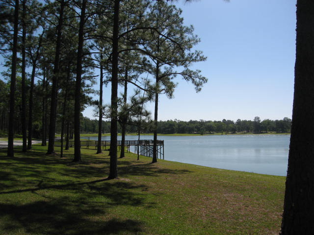
Point A Lake
Point A Lake covers about 820 acres on the Conecuh River, formed by Point A Dam in 1925-26. The name comes from the dam’s original designation during the planning phase — engineers surveyed multiple sites and labeled them alphabetically. Point A was the one they built.
The lake sits upstream of Gantt Lake, creating a stepped impoundment system. Water released through Point A Dam flows into Gantt Lake below. Alabama Power built both dams during the great electrification boom of the 1920s, when south Alabama was getting wired for the first time. PowerSouth Energy Cooperative operates the hydroelectric plant today.
Fishing
Point A produces consistent fishing for largemouth bass, crappie, bluegill (bream), shellcracker (redear sunfish), and channel catfish. Spring is prime time for spawning bass and bedding bream. Crappie fishermen work brush piles and standing timber with jigs and minnows, especially in early spring when the fish move shallow. Catfishing picks up in summer — juglines and trotlines set along creek channels and drop-offs. Bank fishing is popular along accessible shorelines, particularly for families and anglers without boats.
The Alabama Department of Conservation and Natural Resources manages the warm-water fishery. Local knowledge about where the old creek channels run and where submerged structure sits makes the difference between a slow day and a full cooler.
Access and Facilities
Point A Park RV Park and Campground operates year-round on the lake’s shore, offering RV sites with full hookups, tent camping, and direct lake access. Multiple public boat ramps provide entry points for anglers and recreational boaters. The lake has a designated swimming area, though most locals know their own preferred spots on the sandbars and shallow coves.
The shoreline has seen steady residential development — lake houses, private docks, and fishing piers. On summer weekends, the lake fills with pontoon boats, ski boats, kayaks, and johnboats working the bass beds.
Gantt Lake
Gantt Lake stretches about seven miles downstream of Point A, covering roughly 1,570 acres at normal pool. Gantt Dam, completed in 1926, was the larger of the two Alabama Power projects on the Conecuh. The lake’s longer reach and deeper water give it a different character than Point A — more open water, bigger cypress trees standing in the shallows, wider creek arms to explore.
Fishing
Gantt’s fishery mirrors Point A’s — largemouth bass, crappie, bluegill, catfish. Bass fishermen target the cypress trees, submerged stumps, and grass beds along the banks. The lake’s deeper structure holds fish year-round, and the creek channels concentrate crappie during their spring and fall runs. Catfish anglers work the river channel drop-offs and the backs of coves where creeks enter the main lake.
Like Point A, Gantt sees its share of bank fishermen and boat anglers. Local fishing clubs hold tournaments on both lakes through the spring and summer.
Recreation
Gantt supports the same recreational mix as Point A — boating, skiing, wakeboarding, kayaking, swimming from sandbars. The lake’s size gives boats more room to run. Paddlers can explore the upper reaches where the river transitions into the lake, working through cypress stands and quieter water.
Private development lines much of the shoreline, with seasonal lake houses and year-round homes claiming the best points and coves. Public access comes through boat ramps maintained by the county and state.
The Conecuh River
Before there were lakes, there was the river. The Conecuh rises in Pike County near Troy and flows southwest through 105 miles of Alabama — through Butler, Crenshaw, and Covington Counties — before crossing into Florida, where its name changes to the Escambia River. From there, it runs another 55 miles to Escambia Bay and Pensacola.
Historic Waterway
For settlers in the early 1800s, the Conecuh was the link to the outside world. Farmers and traders built flatboats — simple rectangular wooden rafts — and loaded them with agricultural goods, timber, and naval stores. They floated downstream to Pensacola, a journey of several days depending on water levels. The boats were broken up for lumber in Pensacola; there was no practical way to bring them back upstream.
The original county seat, Montezuma, sat on the river at a series of rocky shoals and rapids called “the falls.” This was the head of navigation — flatboats could work below the falls, but upstream travel beyond that point was limited to canoes and small craft. The falls also provided waterpower for mills, making Montezuma a natural gathering point.
The catastrophic flood of 1841 — known as the Harrison Freshet — inundated Montezuma and brought devastating mosquito-borne illness in its wake. The county seat relocated four miles east to higher ground, and Andalusia was born. The falls at Montezuma are largely submerged now under the backwaters of Point A Lake.
Steamboats made periodic attempts to service the Conecuh, but the river’s shallow depth, sandbars, and submerged snags made reliable service impossible. When the railroads arrived in 1899, the river’s role as a commercial waterway ended.
Paddling the Conecuh
The Conecuh below the dams remains a relatively remote paddling river. Canoeists and kayakers launch from bridge crossings and fish camps, working downstream through sandbars, shoals, and wooded banks. The river moves through longleaf pine country in the Conecuh National Forest, offering stretches of undeveloped shoreline and wildlife habitat.
Water levels fluctuate with rainfall and dam releases, so checking conditions before a paddle trip is essential. The river runs through remote country in places — plan accordingly for distance, weather, and access points.
Creek Language
“Conecuh” — the Creek name meaning “land of cane” — refers to the dense canebrakes that once lined the riverbanks. River cane (Arundinaria gigantea) grew in massive thickets throughout the Southeast, reaching heights of twenty feet or more. The Creek people used cane for building materials, baskets, tools, and blowguns. Most of the canebrakes were cleared during settlement, but patches of river cane still grow along the Conecuh’s banks, a remnant of the landscape that gave the river its name.
Open Pond
Open Pond sits deep in the Conecuh National Forest near the community of Wing in southern Covington County. It’s a natural spring-fed pond — likely a sinkhole or solution pond formed in the Coastal Plain sediments — that was developed for recreation by the Civilian Conservation Corps in the 1930s. Some of the original CCC-era stonework and rustic timber construction is still visible.
The Forest Service manages Open Pond Recreation Area today, with a campground, picnic shelters, a fishing pier, and a boat ramp. The pond itself covers about 25 acres and supports fishing for bass, bluegill, and catfish in a forested setting.
Open Pond serves as a trailhead for the Conecuh Trail, a roughly 20-mile hiking loop (with extensions to 26.5 miles) that runs through longleaf pine savanna, bottomland hardwoods, and pitcher plant bogs. The trail is open to hikers, mountain bikers, and horseback riders on its northern section.
Blue Spring and Other Springs
The Conecuh National Forest area holds several natural springs where groundwater flowing through sandy aquifer layers meets impermeable clay and forces to the surface. Blue Spring is notable for its clear, blue-tinted water — the color caused by light absorption and scattering in the mineral-rich water. These springs provide permanent water sources for wildlife and contribute baseflow to the streams feeding the Conecuh River.
Seepage bogs and smaller springs occur throughout the forest wherever the water table intersects the surface, supporting unique habitats including the carnivorous pitcher plant bogs that thrive in the wet, acidic soils.
Seasons and Patterns
The water culture in Covington County follows a seasonal rhythm. Spring brings spawning fish, rising lake levels from rainfall, and the opening of crappie season. Summer means long days on the lake — skiing, swimming, fishing for bass in the early morning and late evening when the heat breaks. Fall sees dropping water levels, bass moving to deeper structure, and the return of comfortable temperatures for bank fishing. Winter is catfish season for the diehards and maintenance season for boats and docks.
Hurricanes and tropical systems bring periodic floods — the Conecuh can rise dramatically after Gulf storms push rainfall inland. The dams provide some flood control, but the river still claims its floodplain during major events. Anyone who lives near the water understands the pattern: enjoy it most of the year, respect it when it rises.
These lakes and rivers aren’t just recreation — they’re woven into the identity of the place. You grow up fishing Point A with your grandfather, learn to ski on Gantt, camp at Open Pond with your Scout troop. The water is where Andalusia goes when work is done.